Measuring Distance
In the Map module, you can measure the distance between two points on the map.
To do this, click ![]() button,
select the point on the map and drag the mouse to the second point
to trace a path to measure (Figure: Measuring Distance). The measured
distance will be expressed both in metric and English units of
measure.
button,
select the point on the map and drag the mouse to the second point
to trace a path to measure (Figure: Measuring Distance). The measured
distance will be expressed both in metric and English units of
measure.
Note: Measuring is calculated using the latitude and longitude coordinates from point to point and does not consider elevation.
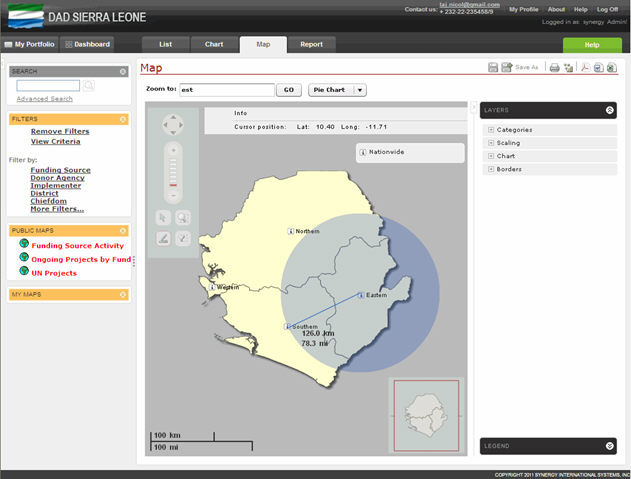 |
Figure: Measuring Distance |