Zooming in / Zooming out
The GIS tool is equipped with the advanced zooming capabilities used to enlarge or reduce the view of the map on the screen. The following zooming options are available:
Free zoom in / zoom out
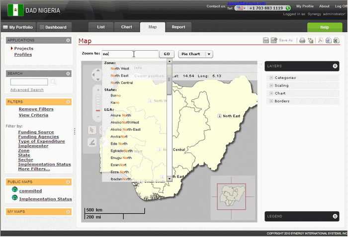
This option allows you to easily explore the data through Intelligent Searching. You can enter any combination of letters in the Zoom to panel and select the administrative territory (district) to navigate to from the list containing the search results (Figure 18). The selected item will be magnified and displayed in the main screen.
 |
Figure 18: Intelligent Searching |
Scaled zoom in / zoom out
This option allows zooming in / zooming out using the scale tool available in the Advanced GIS.
This means that when changing the zoom scales by clicking either
on![]() or
or![]() ,
, ![]() you can
magnify or reduce the viewport according to the scale value.
you can
magnify or reduce the viewport according to the scale value.
Mouse wheel-based zoom-in/zoom-out
This option supports mouse wheel-based zooming in / zooming out. In order to enlarge or reduce the viewport using the scroll wheel button of the mouse, you should click anywhere on the map and use the wheel button in the backward motion to zoom in and in the forward motion to zoom out.
Zoom by Selection
This option allows magnifying the original viewport or a portion
of it using the mouse. To be able to enlarge an area on the map,
you should activate the Zoom
by Selection option by clicking the ![]() button
then select a region on the map to magnify.
button
then select a region on the map to magnify.