Viewing the Data Displayed on the Map
The Advanced GIS
tool is used to view the data referring to definite territorial
units – provinces and/or cities/villages when zoomed in to this
level. In order to access the data for a specific territorial
unit, point the mouse cursor on the ![]() button
(Figure 24). The information that is displayed in the information
window includes but is not limited to # of people in need of shelter,
# of houses totally destroyed, estimate # of households, etc.
If you have plotted any chart category on the map, the chart
category details appear in the information window as well.
button
(Figure 24). The information that is displayed in the information
window includes but is not limited to # of people in need of shelter,
# of houses totally destroyed, estimate # of households, etc.
If you have plotted any chart category on the map, the chart
category details appear in the information window as well.
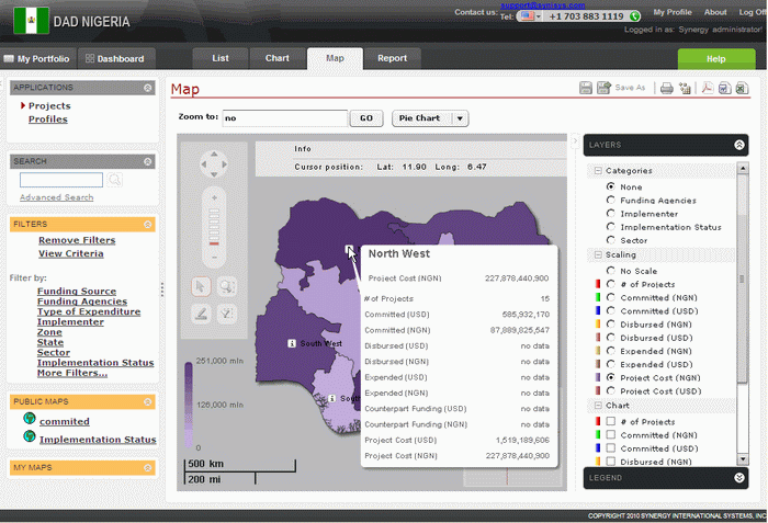 |
Figure 24: Viewing the Data Displayed on the Map |